|
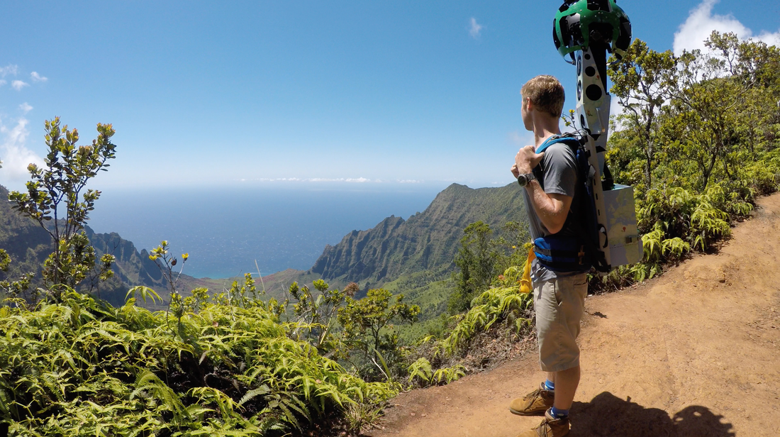
By: Myles Ritchie Update: In February 2017, TOC was approached by Google in order to partner with them on their “Trekker” program which allows virtual tours to be placed on Google Maps. This same process can already be seen with Google’s “Street View” application on Google Maps and is accomplished by carrying a 50-pound backpack with 15 cameras on top that take a 360-degree panoramic image every 2.5 seconds. The Outdoor Circle was contacted by Google for this program due to our historical prominence throughout the state and for our recent innovative mapping programs. As a result, undertaking this project and forming this partnership with Google was a natural progression from TOC’s “Exceptional Tree Map” and “Citizen Forester” programs. Since that initial contact, TOC’s Programs Director, Myles Ritchie, and various interns have used the Trekker on the Big Island, Kauai, Oahu and Maui in order to highlight some of Hawaii’s most iconic and unique environmental locations in addition to those of historical and cultural significance. The types of locations range from lava flows, the first two miles of the Napali Coast Trail, National Tropical Botanical Gardens and Waimea Outdoor Circle's Ulu La’au Nature Park, to name a few. However, it is important to note that the Trekker was not used at “secret” areas in order to preserve their current conditions. Instead, well-known areas have been featured with permission from various County, State and Federal agencies in addition to private property owners. It is important to note that this program was made possible due to a grant from HECO which has supported TOC’s mission and this program of allowing individuals to virtually visit these incredible areas regardless of financial, physical or other potential limiting factors. We would also like to thank the Hilo Reeds Bay Hotel for partnering with us for the Big Island portion of the data collection. This has been, and will continue to be, one of the most innovative programs TOC has ever worked on and will literally put TOC and many well known Hawaiian locations on the map for a global audience to experience and enjoy. Below are the links to the various locations which are now live on Google Maps. Maui will be uploaded sometime in April or May so please check back for additional updates in the months to come. We hope you will enjoy this incredible set of imagery and the virtual journeys they will take you on. Mahalo for supporting TOC and its mission of "keeping Hawaii clean, green and beautiful." We would like to extend a big mahalo to our interns Ben Ritchie, Ireland Derby and Richard Jansen for all of their help with this project! Big IslandComments are closed.
|
Welina!The Greenleaf is the online newsletter and blog of The Outdoor Circle. Here you will find updates on the projects and accomplishments of our many branches throughout the state, as well as programs with statewide impact. Archives
September 2023
Categories
All
|


 RSS Feed